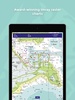


Navigator is a chart plotter app designed for maritime navigation, ideal for sailors, boaters, and marine enthusiasts. Its primary purpose is to provide reliable access to detailed nautical raster charts, including those from Imray and other Hydrographic Offices, ensuring precise navigation. The app supports plotting, editing, and sharing routes or waypoints while offering GPS-based features such as boat position, speed over ground, and course over ground.
Key Features for Effortless Marine Navigation
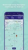
Navigator enhances your journey with features like data overlays that include useful navigation notes and marina details. It also enables you to track your trips, measure distances, and edit plotted courses. Regular chart updates ensure accuracy, keeping your navigation tools current.
Seamless Integration Across Devices
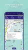
Navigator supports synchronization through its login system, allowing you to share chart subscriptions and navigation plans across multiple platforms. This feature ensures that your maritime data is accessible whenever and wherever you need it.
Navigator offers all the essential tools for safe and efficient navigation, making it a valuable companion for your nautical adventures.
Requirements (Latest version)
- Android 10 or higher required
Comments
There are no opinions about Navigator yet. Be the first! Comment